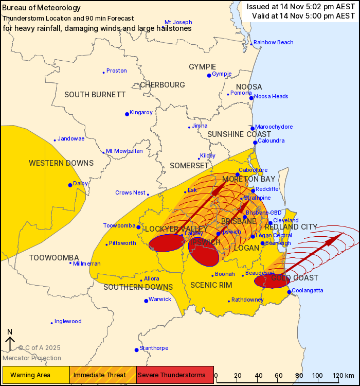
UPDATE @ 5.00PM | A severe storm warning has been issued for the Gold Coast as we brace for a few days of wild weather.
“The Bureau of Meteorology warns that, at 5:00 pm, severe thunderstorms likely to produce heavy rainfall that may lead to flash flooding, damaging winds and large hailstones were detected near Miami, Mudgeeraba, Peak Crossing, Mulgowie and Nerang,” the BOM warning states.
“These thunderstorms are moving towards the northeast. They are forecast to affect Ipswich, Laidley and Gatton by 5:45 pm and Brisbane CBD, Strathpine and Caboolture by 6:30 pm.”
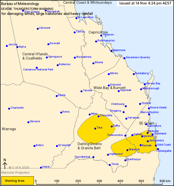
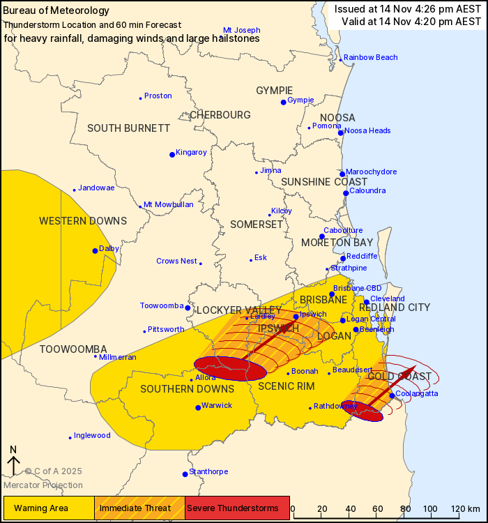
EARLIER | At 4.20pm, the Bureau of Meteorology issued a warning for Logan, Scenic Rim, Southern Downs, Toowoomba, Lockyer Valley, Gold Coast and Somerset Council Areas.
It warns that severe thunderstorms that could produce heavy rainfall that may lead to flash flooding, damaging winds and large hailstones were detected near Springbrook and Aratula.
These thunderstorms are moving towards the northeast. They are forecast to affect Coolangatta, Numinbah Valley and Little Nerang Dam by 4:50 pm and Ipswich, Laidley and Nerang by 5:20 pm.
A second, broader storm warning is also in place for the Gold Coast and other parts of Queensland.
“Severe thunderstorms are supported by a moist unstable airmass in southern and southeastern parts of the state. Storms are expected to continue moving northeast into the evening before weakening,” the warning states.
“Severe thunderstorms are likely to produce damaging winds, large hailstones and heavy rainfall that may lead to flash flooding in the warning area over the next several hours. Locations which may be affected include Warwick, Gold Coast, Brisbane, Dalby, Ipswich, Cleveland, Jimboomba and Coolangatta.”