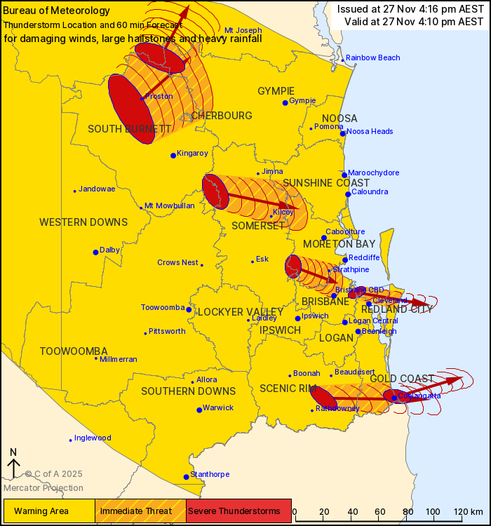
UPDATE @ 4.25pm | Fresh storm warnings have been issued for the Gold Coast as severe cells sweep across the south east for a fifth day in a row.
“The Bureau of Meteorology warns that, at 4:10 pm, severe thunderstorms likely to produce damaging winds, large hailstones and heavy rainfall that may lead to flash flooding were detected near Coolangatta, Proston, the D’Aguilar Ranges, Wynnum, Laravale and the ranges south of Gayndah,” a BOM warning states.
“These thunderstorms are moving towards the east to northeast. They are forecast to affect the area west of Kilcoy, Numinbah Valley and Little Nerang Dam by 4:40 pm and Brisbane CBD, Strathpine and Kilcoy by 5:10 pm.”
3-4 cm hail was reported at Bardon and Ashgrove at about 3:30pm
2-3 cm hail was reported at Milton at 3:25pm
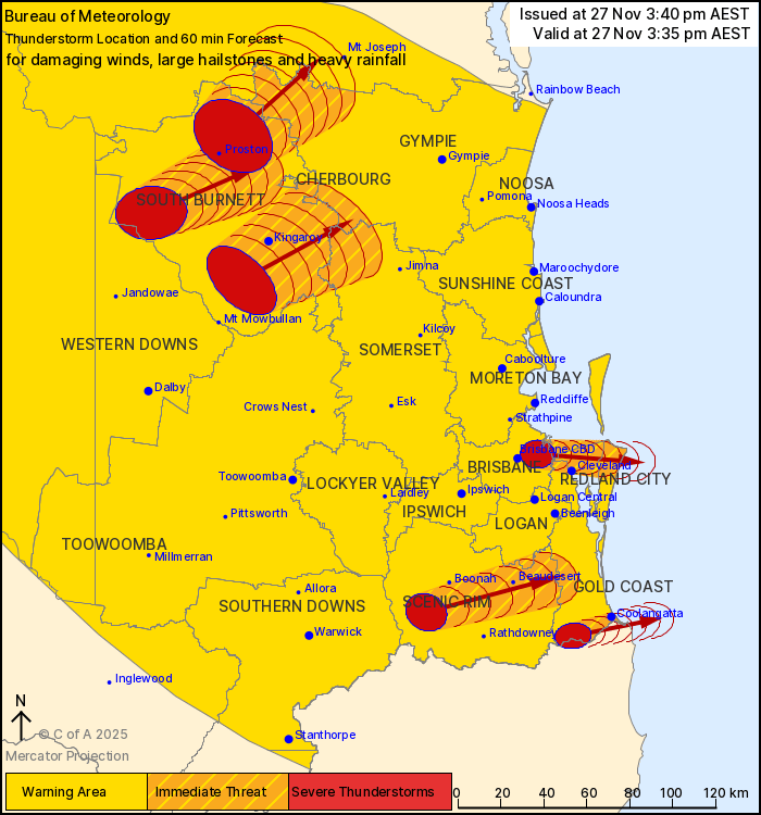
UPDATE @ 3.45pm | A severe storm warning has been issued as multiple cells move towards the Gold Coast and other parts of the southeast.
The Bureau of Meteoology warns that cells that could produce damaging winds, large hailstones and heavy rainfall that may lead to flash flooding were detected near Proston, the area south of Kingaroy, Springbrook, the area west of Kingaroy, Wynnum and Moogerah.
These thunderstorms are moving towards the east to northeast. They are forecast to affect Coolangatta, Cleveland and Kingaroy by 4:05 pm and Beaudesert, the area northeast of Kingaroy and Canungra by 4:35 pm.
Some areas further west have already seen hail as large as 4 centimetres this afternoon.
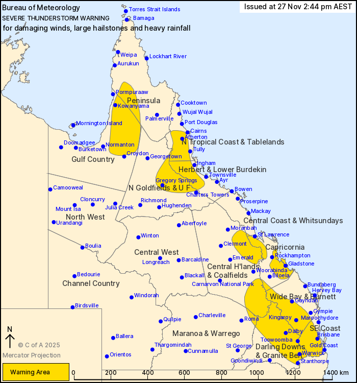
EARLIER @ 2.50pm | A severe thunderstorm warning has been issued for the Gold Coast and much of the south east, as we brace for a fifth day of storm activity.
The Bureau of Meteorology issued the alert around 2.50pm for the Southeast Coast, stating that severe thunderstorms were likely to develop over the coming hours.
“Moisture and instability persist to the east of a surface trough through eastern Queensland, resulting in a broad risk of severe thunderstorms,” the warning states.
“About the southeast this trough is forecast to push offshore during the late afternoon and early evening.
“Severe thunderstorms are likely to produce damaging winds, large hailstones and heavy rainfall that may lead to flash flooding over the next several hours in the Southeast Coast and parts of the Central Highlands and Coalfields, Capricornia, Wide Bay and Burnett, Maranoa and Warrego and Darling Downs and Granite Belt districts. Locations which may be affected include Warwick, Gold Coast, Toowoomba, Brisbane, Dalby, Maroochydore, Gympie, Kingaroy, Stanthorpe, Coolangatta and Ipswich.”