
A tropical low weather system that’s threatening to develop into a cyclone is barrelling towards the north Queensland coast.
A severe weather warning has now been issued for a large stretch of coastal areas from Hamilton Island to the north of Cairns, with residents being warned to brace for heavy rainfall and damaging winds.
“A broad tropical low has formed in the Coral Sea and will begin slowly moving towards the northeast Queensland coast over the next few days before moving inland over the weekend,” the Bureau of Meteorology said.
“Heavy rainfall which may lead to flash flooding is forecast to develop during Friday and continue into Saturday.
“Six-hourly rainfall totals between 100 to 150 mm are likely, with isolated falls in excess of 200 mm possible.
“East to southeasterly damaging winds averaging 55 to 65 km/h with wind gusts around 90 km/h are also possible during Friday and Saturday, particularly about coastal areas in showers and thunderstorms.”
Locations which may be affected include Cairns, Yarrabah, Wujal Wujal, Port Douglas, Hope Vale, Atherton, Mareeba, Palm Island, Cardwell, Ingham, Ayr, Townsville, Bowen, Airlie Beach and the Whitsunday Islands.
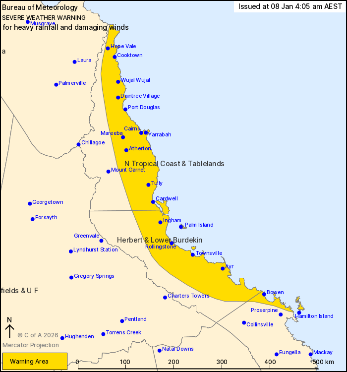
The weather bureau said conditions could begin to ease about the North Tropical Coast by Saturday evening but may persist into Sunday over parts of the Herbert and Lower Burdekin.
“This is dependent on the development and location of the tropical low,” BOM said.
“The low is being monitored closely and if further strengthening is likely then a Tropical Cyclone Advice may be issued”.


