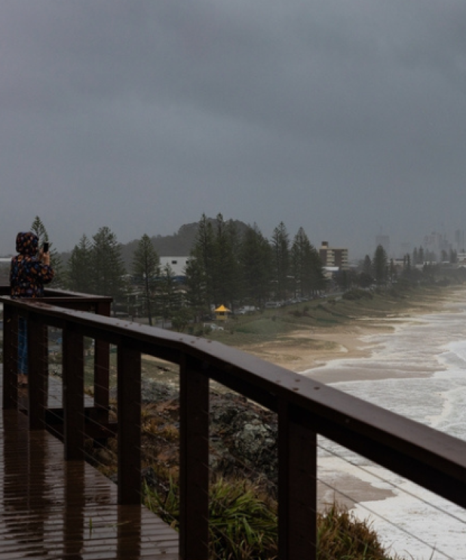
The Gold Coast is on storm watch again today, with the threat of destructive supercells hitting the region.
The weather bureau has warned severe storm activity is possible over the next 48 hours, which could bring large hail, damaging winds and heavy rainfall.
Jonathon How from the Bureau of Meteorology says the worst of the wild weather is expected on Saturday.
“The Gold Coast and pretty much all the South East Queensland is in for a number of days of pretty unsettled weather and we are expecting to see severe thunderstorms over the next few days, really peaking tomorrow,” Mr How told myGC.
“For the rest of today, we have seen some showers and storms overnight, that’s cleared off but we could see some storms redeveloping early this afternoon and into the evening.
“For the Gold Coast, we may see some severe thunderstorms this afternoon and we could see some large hail and damaging winds with some of those storms later today, but tomorrow is looking to be the biggest storm day of the week.
“So we will see south thunderstorms developing in the late morning but really peaking into the afternoon and evening
“For the Gold Coast we could see heavy rainfall, damaging winds, as well as large hail and there is the slight risk of seeing supercell thunderstorms bringing giant hail, as well as destructive winds tomorrow.
Mr How says a surface trough lying over the South East Coast of Queensland is to blame for the wild weather.
“That’s dragging in more tropical moisture so really boosting those humidity levels, but tomorrow we will see a wind change move up the coast and combining with that humidity and the surface trough it will trigger quite widespread thunderstorms tomorrow.
“We will see showers and storms continue into Sunday as well but less likely to be severe.
“We will see those showers continuing, really only easing up into early next week so quite a few days and pretty soggy and potentially dangerous weather on the way”.
Meantime, the Bureau is assuring us its new rain radar will hold up after it went down for almost two hours during yesterday’s storm action.
“We are aware that the rain radar images were briefly unavailable on our website and also the app,” Mr How said.
“It was in no way related to the new website, but images are back online now.
“We managed to investigate that pretty quick smart and it should be all good to go for today and tomorrow”.